The Queen of Chotanagpur: a quiet plateau hill station 156 km west of Ranchi, known for its sunsets.
Lesser-knownHill-stationWaterfallVillage
Netarhat is the highest point of the Chotanagpur plateau and one of the few hill stations in eastern India. It is a thinly built place of pine and sal forest, a famous residential school, and two viewpoints that face opposite ways so you can watch the sun rise over one valley and set behind another on the same day. There is no resort strip and very little traffic, which is the appeal.
Trip planner
Plan from your city
Photos
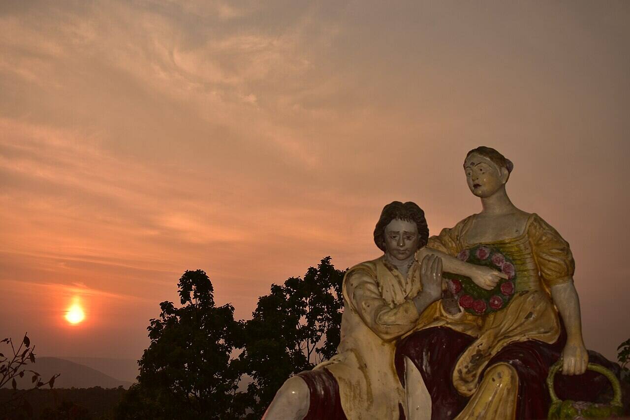
Sunset at Magnolia PointNetarhat Residential SchoolThe gate at Netarhat
Photos from Wikimedia Commons. Select a photo for its author and licence.
Best time to go
When
What to expect
October to March
The season. Clear air, cold mornings, and the best chance of a sharp sunset from Magnolia Point. December and January nights can approach freezing.
July to September
The monsoon turns the plateau green and fills the Ghaghri falls, but mist often closes in and the viewpoints show nothing.
April to June
Warm on the plains but still pleasant up here, and much quieter. The waterfalls run low.
Sights and activities
1
Magnolia Point
The sunset viewpoint, named for an English girl in a local story about a shepherd boy. It looks west over the Ghaghri valley and is the thing Netarhat is known for.
A boys' residential school founded in 1954 on the plateau, well known across eastern India. The campus and its grounds are part of the character of the place; it is a working school, not a sight to wander into.
State and private buses run Ranchi to Netarhat via Lohardaga and Ghaghra, taking about 4 to 5 hours on a road that climbs through forest at the end. Services are infrequent and mostly morning; the last bus back leaves early in the afternoon.
By train
Netarhat has no railway. Ranchi (RNC) is the practical railhead, 156 km away, with trains from Delhi in about 17 to 20 hours and from Howrah in about 8 to 9 hours. Daltonganj, about 118 km, is the other option and is closer to Betla.
By air
Ranchi airport is the nearest, about 160 km and 4 hours away by road.
Where to base yourself
There is very little accommodation: the state tourism property, a forest rest house and a handful of small hotels, all within a couple of kilometres of the bus stand. Book ahead, since choice is thin at weekends.
Getting around
The town is small and the Koel viewpoint is walkable; everything else needs a vehicle.
Jeeps and taxis can be hired in the town for Magnolia Point and the falls, usually as a half-day rate.
There is no autorickshaw network and almost no public transport within the plateau.
Lodh Falls and Betla need a full day and a hired car with a driver who knows the roads.
Often combined with
Places people usually visit on the same trip, and how long it takes to get between them.
The best available rooms locally, or a resort in Ranchi with a car
₹4,000 to ₹7,000
Food
Eating options are very limited and close early. Most visitors eat where they stay and arrange dinner in advance. Carry snacks for the drives to the falls.
Try these
Dhuska, a deep-fried rice and lentil bread eaten with ghugni
Litti chokha, shared with neighbouring Bihar
Rugra, a wild mushroom from the sal forest, cooked in season after the monsoon
Handia, a traditional fermented rice drink
Thekua, a wheat and jaggery sweet
Vegetarian food is the default in the small kitchens here and easy to get.
Daily costs
Budget level
Stay per room
Food per person
Local transport
Budget
₹900
₹350
₹400 per person
Mid-range
₹2,500
₹700
₹1,800 per vehicle
Luxury
₹5,000
₹1,300
₹3,500 per vehicle
Per day. Travel to and from your city is added in the planner above.
Permits and documents
No permits are needed for the plateau. Betla National Park charges entry and safari fees and has its own timings. Carry photo ID for hotel check-in.
Safety
By day
A quiet forest town with no particular problems. Viewpoints are unfenced in places and the ground near the falls is slippery; keep back from wet rock.
At night
The plateau is dark and empty after sunset, with no street lighting outside the town centre. Do not walk the forest roads at night.
Solo women
No specific safety information was found. The town is small and quiet; usual care applies, and travel between Ranchi and Netarhat is best done in daylight.
Roads
The Ranchi to Netarhat road is narrow and climbs through forest, with few places to stop. Avoid driving it after dark. The road to Lodh Falls is rough.
Emergency numbers
112 (all emergencies), 108 (ambulance)
Practical
Mobile network
Coverage on the plateau is reported as patchy and limited to one or two operators.
ATMs and cash
There is no reliable machine. Withdraw in Ranchi or Lohardaga and carry cash.
Fuel
Fill up in Lohardaga, about 60 km before the climb.
Medical
Only a primary health centre. Anything serious means Daltonganj or Ranchi, several hours away.